
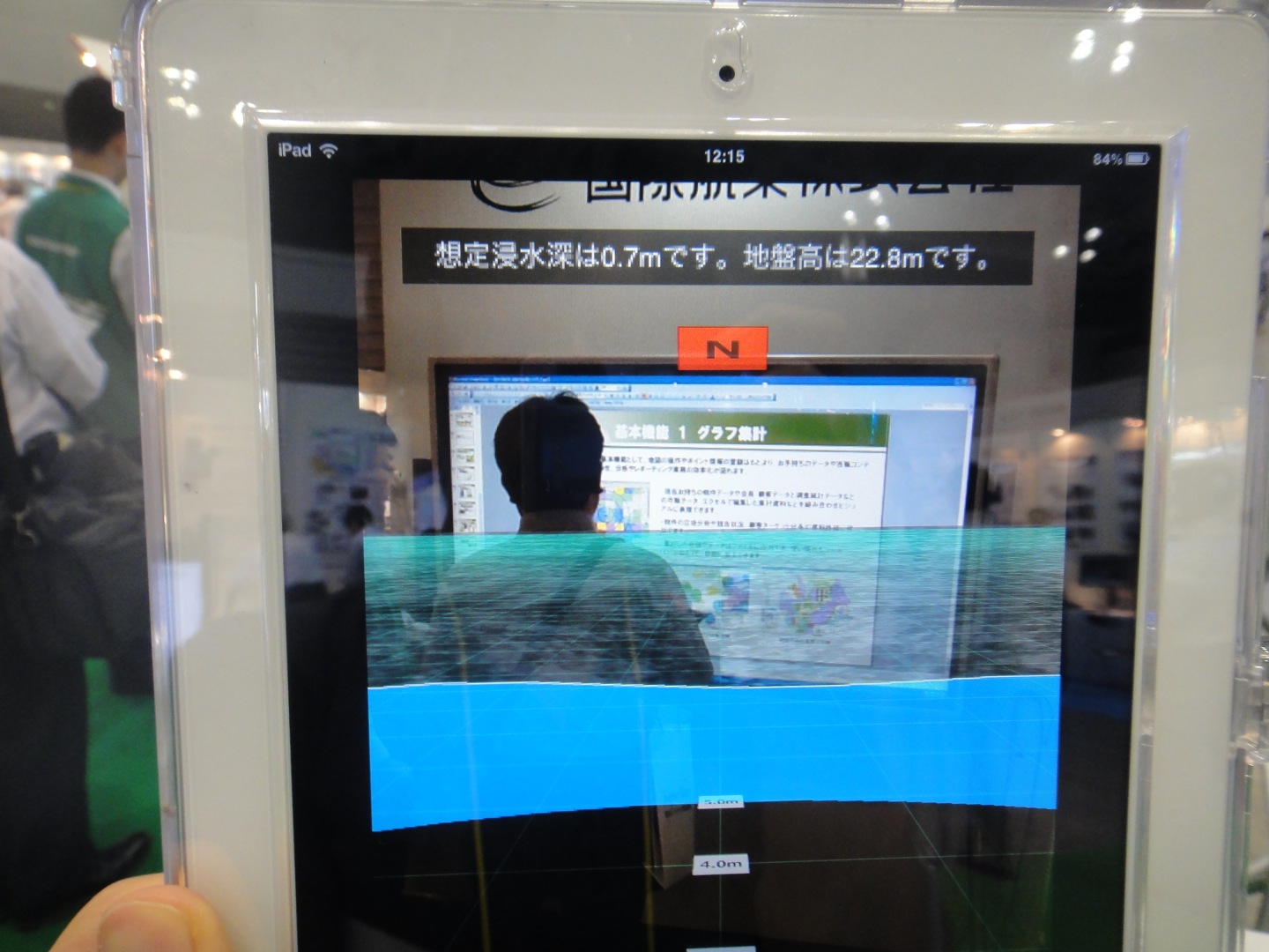
Kokusai Kogyo is developing a disaster prevention AR application the can visualize the depth of water in the event of a tsunami or flooding. With this prototype, the water level five meters ahead is superimposed on the view from the camera of an iPad.
[youtube id=”zVKFaWblb60″ width=”600″ height=”340″ position=”left”]
“Hazard maps are distributed in printed form or published on Web sites, but people don’t know what the situation would be where they are right now. So, we want to let people know, right away, what would happen where they are now, using a smartphone and its camera.”
“The basis for this system is the accurate reflection of information about the elevation of the ground. At Kokusai Kogyo, our original business is doing aerial surveys, to obtain data for making maps. So, this system is based on more accurate elevation information than the data that’s generally used.”
“The expected height of a tsunami depends on the earthquake that causes it. So, we wanted to show what would happen for each earthquake, if it was of a magnitude that occurs a once a century, or once a millennium.”
“At present, it’s difficult to digitize all elevation data nationwide and all data published by local governments. So first of all, we’d like to provide our data on a contract basis, to organizations that are interested, including local governments and nationwide franchise operators. The idea is to support business continuity planning.”